
- map - East Palestine location on map
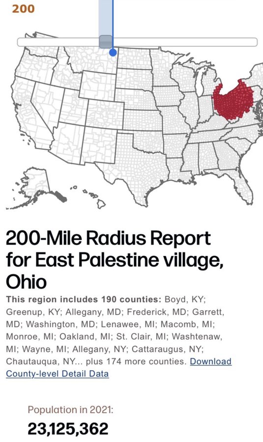
https://pic8.co/sh/tWVIRP.jpg | https://www.imgbly.com/ib/351rBcDVLA.jpg - map - 200 mile radius report for danger
https://pic8.co/sh/aoGvjR.jpg | https://take-me-to.space/Cf55ZWTI.jpg - map - animals reported dead due to intentional disaster, over 100 miles away
https://pic8.co/sh/oqjI9S.png | https://take-me-to.space/Gn9ygrW.png - map - Some cities within 100 miles Radius of East Palestine with reports of serious issues
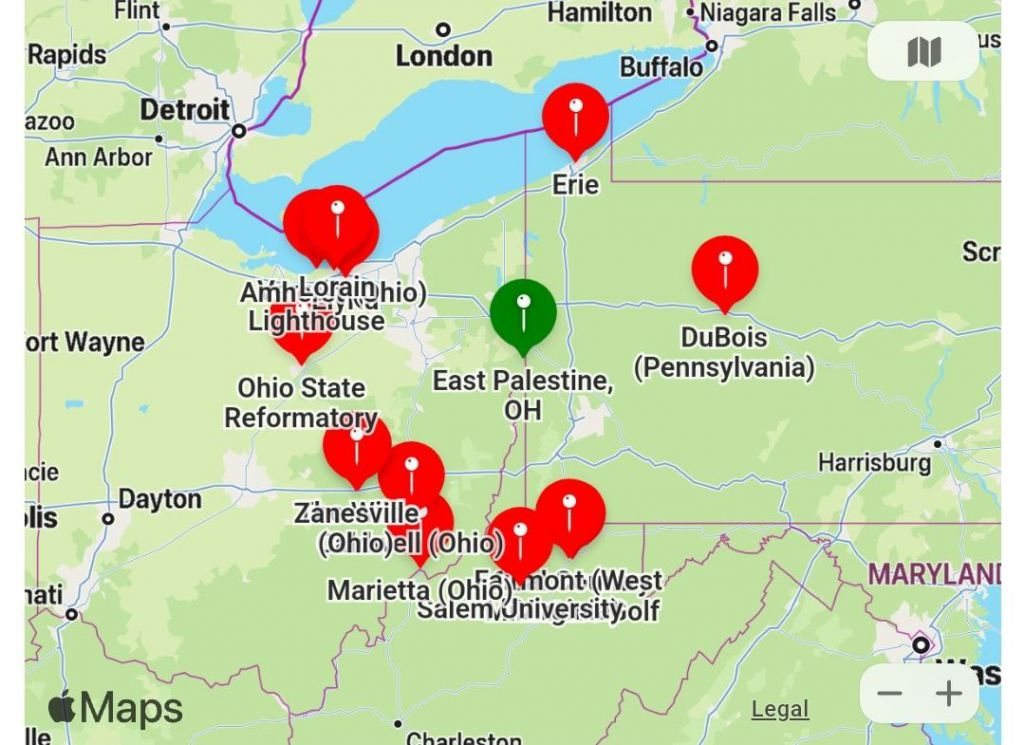
https://pic8.co/sh/heVNla.jpg | https://www.imgbly.com/ib/cq8loiZ0yz.jpg - map - Some cities within 200 miles Radius of East Palestine with reports of serious issues
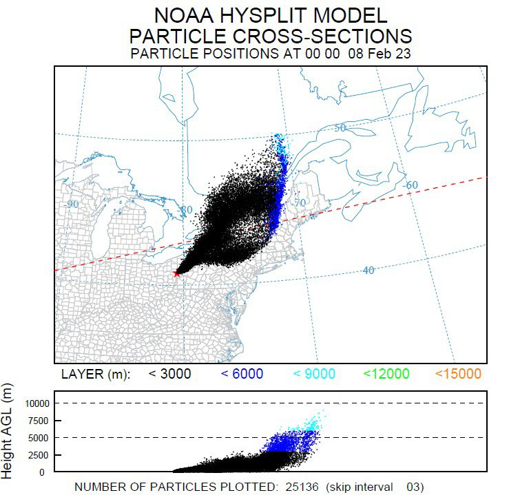
https://pic8.co/sh/KXIbSk.jpg | https://www.imgbly.com/ib/BTIHG4XkYG.jpg - map - NOAA map of estimate fallout zone for airborne gas released from intentional burn
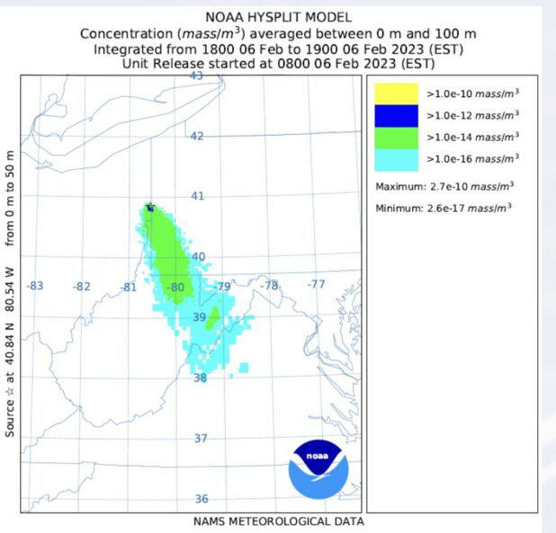
https://pic8.co/sh/F9Yaev.png | https://take-me-to.space/wZhINGF.png - map - NOAA map of estimate fallout zone for airborne gas released from intentional burn going all the way down into the Virginias
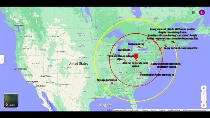
https://pic8.co/sh/hZ2ZrV.jpg | https://take-me-to.space/VP78nadU.jpg - map - Another map noting locations and types of issues reported
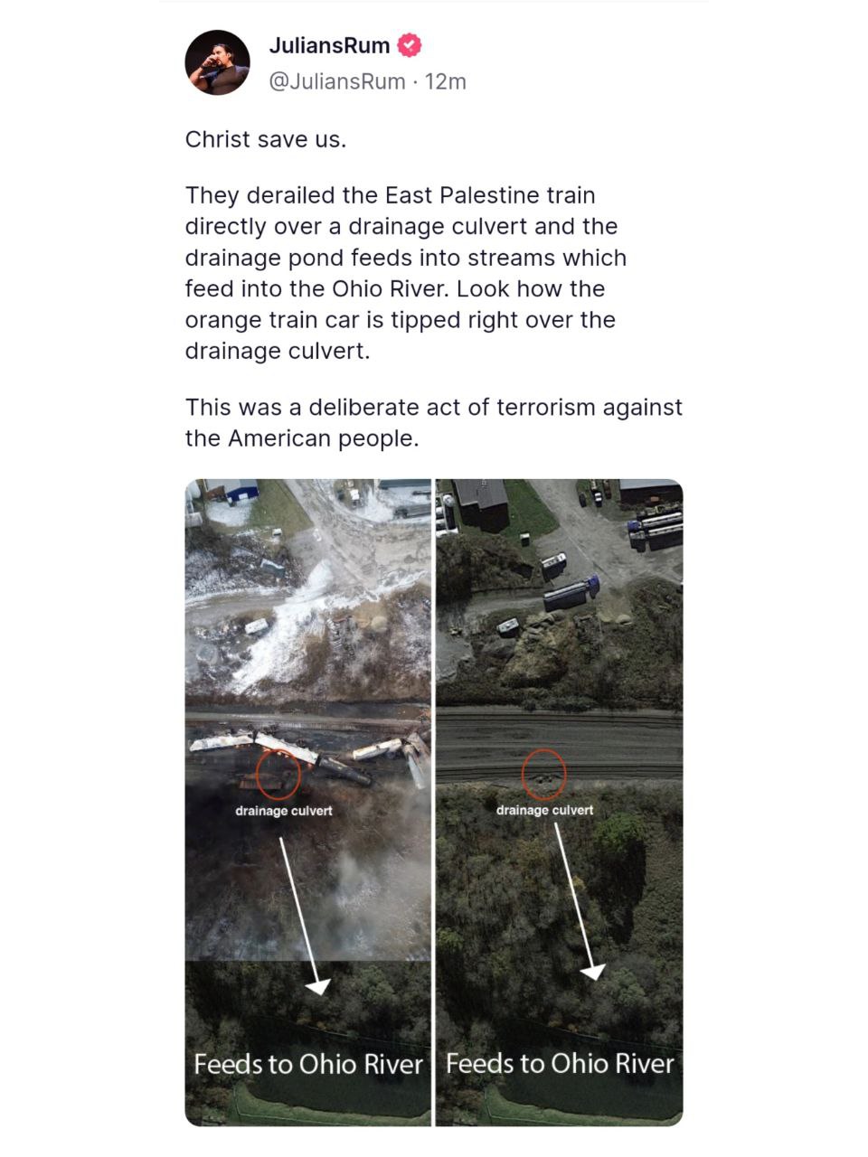
https://pic8.co/sh/ni9ktX.png | https://take-me-to.space/XvDeud9.png - train derailed right over drainage culvert that feeds into Ohio River 1
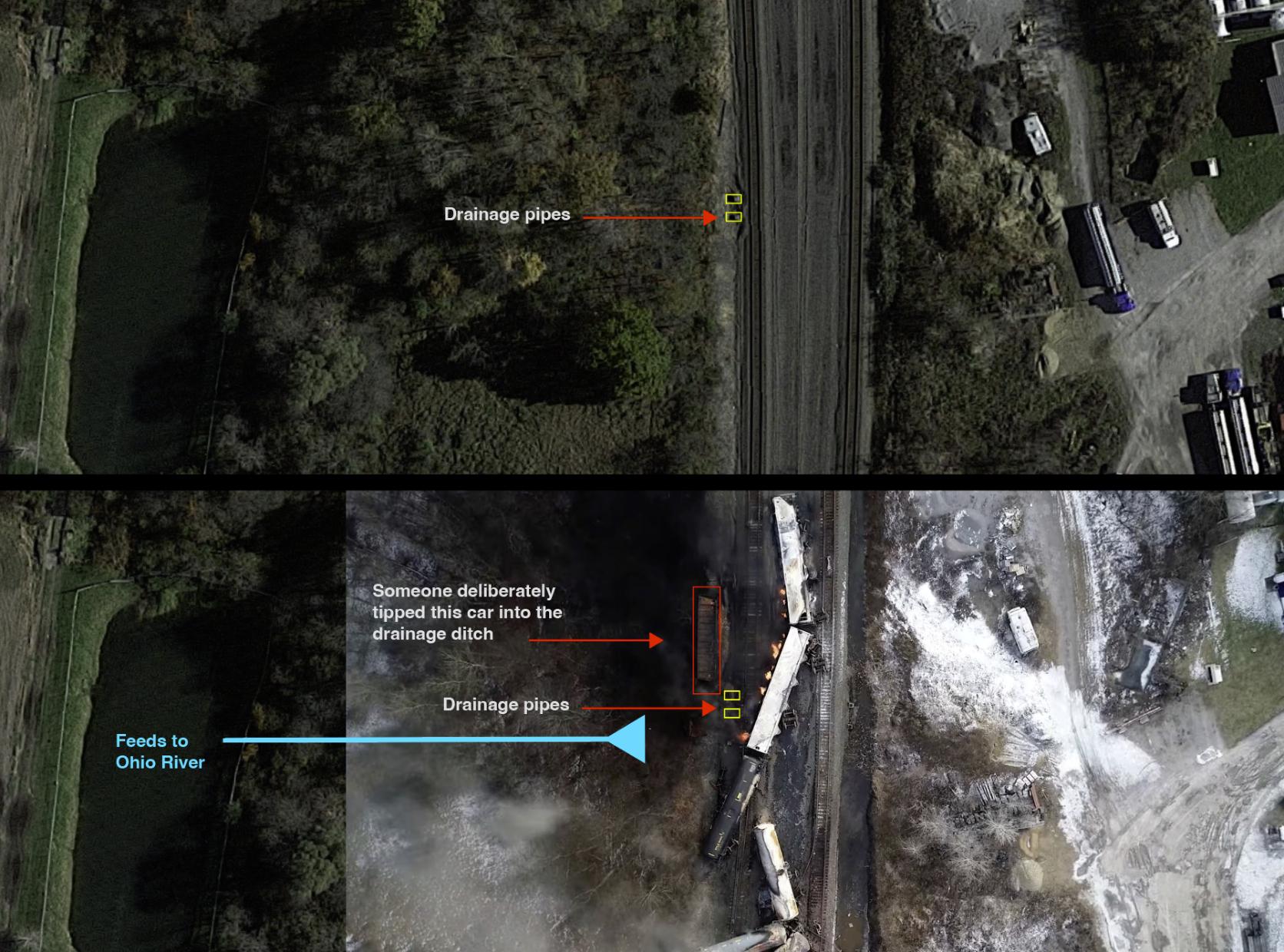
https://pic8.co/sh/ZQw6R3.jpg | https://take-me-to.space/OcKzBmz.jpeg - train derailed right over drainage culvert that feeds into Ohio River 2
https://pic8.co/sh/bTYG5J.jpg | https://take-me-to.space/oV4qrxkA.jpg
- map - East Palestine location on map
https://pic8.co/sh/tWVIRP.jpg | https://www.imgbly.com/ib/351rBcDVLA.jpg
- map - 200 mile radius report for danger
https://pic8.co/sh/aoGvjR.jpg | https://take-me-to.space/Cf55ZWTI.jpg
- map - animals reported dead due to intentional disaster, over 100 miles away
https://pic8.co/sh/oqjI9S.png | https://take-me-to.space/Gn9ygrW.png
- map - Some cities within 100 miles Radius of East Palestine with reports of serious issues
https://pic8.co/sh/heVNla.jpg | https://www.imgbly.com/ib/cq8loiZ0yz.jpg
- map - Some cities within 200 miles Radius of East Palestine with reports of serious issues
https://pic8.co/sh/KXIbSk.jpg | https://www.imgbly.com/ib/BTIHG4XkYG.jpg
- map - NOAA map of estimate fallout zone for airborne gas released from intentional burn
https://pic8.co/sh/F9Yaev.png | https://take-me-to.space/wZhINGF.png
- map - NOAA map of estimate fallout zone for airborne gas released from intentional burn going all the way down into the Virginias
https://pic8.co/sh/hZ2ZrV.jpg | https://take-me-to.space/VP78nadU.jpg
- map - Another map noting locations and types of issues reported
https://pic8.co/sh/ni9ktX.png | https://take-me-to.space/XvDeud9.png
- train derailed right over drainage culvert that feeds into Ohio River 1
https://pic8.co/sh/ZQw6R3.jpg | https://take-me-to.space/OcKzBmz.jpeg
- train derailed right over drainage culvert that feeds into Ohio River 2
https://pic8.co/sh/bTYG5J.jpg | https://take-me-to.space/oV4qrxkA.jpg
woah, thank you for the compilation. its kind of terrifying! guess Indiana is out of the question, unless they stop reporting oily film by the end of the year
woah, thank you for the compilation. its kind of terrifying! guess Indiana is out of the question, unless they stop reporting oily film by the end of the year
You never cease to amaze me. Thank you for all these maps!
You never cease to amaze me. Thank you for all these maps!
(post is archived)