

![Do any of you have any info on what caused this streak of cancer rates in the north east? [1066x366 - 29KB]](https://poal.co/static/images/4YRUcH.jpg)
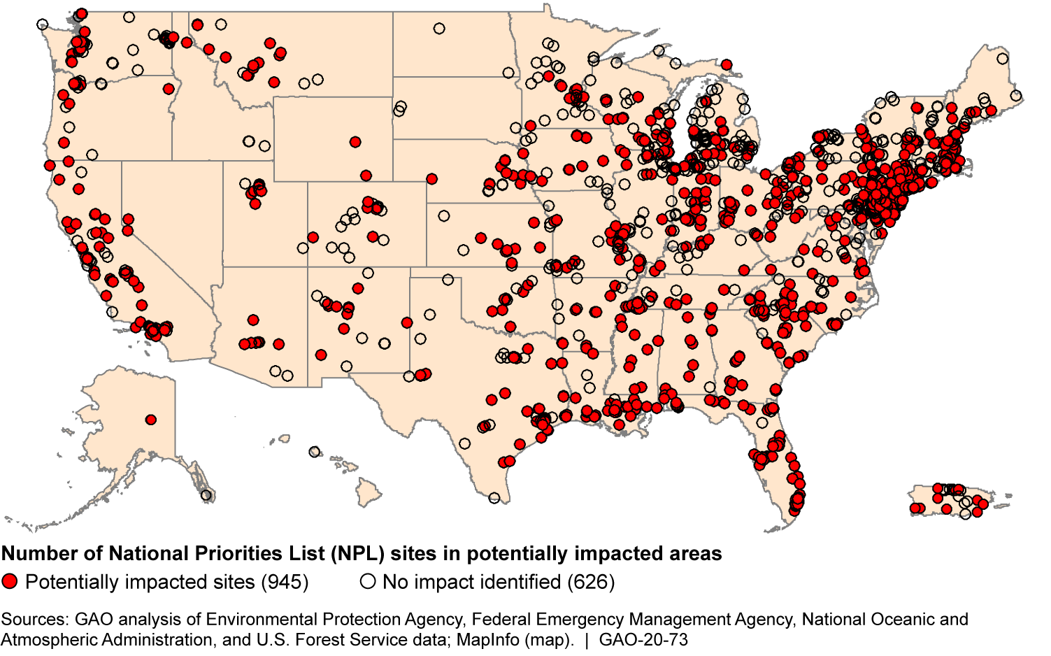
How well does that overlay with the superfund industrial cleanup site map?
How well does that overlay with the superfund industrial cleanup site map?
Pretty damn closely: https://www.indianaenvironmentalreporter.org/content/posts/20191121-nearly-half-of-indiana-superfund-sites-threatened-by-climate-change-effects/1.png
That looks closer than I expected honestly. When I chose where to live, the quality and cleanliness of the major aquifers in the region was one of my main sticking points. I'd imagine the groundwater in the NE still has not recovered from all that industrial waste dumping.
That looks closer than I expected honestly. When I chose where to live, the quality and cleanliness of the major aquifers in the region was one of my main sticking points. I'd imagine the groundwater in the NE still has not recovered from all that industrial waste dumping.
How can you figure that information out? What do you do if you live somewhere that has bad water?
How can you figure that information out? What do you do if you live somewhere that has bad water?
Dead link
Dead link
(post is archived)